The Zones Project 2020
What if a one megaton nuclear bomb hit downtown Portland?
Most nuclear weapons owned by the United States and other nuclear powers are much stronger than the 20 kiloton bomb exploded in 1945. But on this 70th anniversary of the only military use of an atomic weapon (on a civilian population) we recall what happened in Hiroshima and in Nagasaki three days later.
Consider ways you can display these posters to remind people around the Portland Metro area of the grim reality of the world's nuclear nightmares. (Click on your zone to download an 8.5x11 poster; enlarge to 155% for 11x17.)
The zones are:
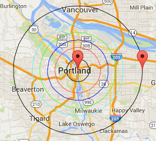
![[Zone 1]](zones2005/zone1.gif) 1.5 miles. All life and buildings
pulverized.
1.5 miles. All life and buildings
pulverized.
North Boundary: Knott & N. Vancouver
East Boundary: 25th & E Burnside
South Boundary: Clinton St (extended into Willamette River)
West Boundary: 20th & W Burnside
![[Zone 2]](zones2005/zone2.gif) 3 miles. Lung hemorrhage, third
degree burns.
3 miles. Lung hemorrhage, third
degree burns.
North Boundary: N Emerson & Vancouver
East Boundary: 48th & E Burnside
South Boundary: SE Steele (extended into Willamette River)
West Boundary: 3800 Pittock Dr
![[Zone 3]](zones2005/zone3.gif) 4 miles. Brick and frame houses
destroyed, ear drum rupture.
4 miles. Brick and frame houses
destroyed, ear drum rupture.
North Boundary: N Bryant (7000 blk) & Commercial
East Boundary: 66th & E Burnside
South Boundary: SE Bybee Bv (7000 blk) (extended into Willamette River)
West Boundary: 5800 blk in Mt. Calvery Cemetary
![[Zone 4]](zones2005/zone4.gif) 5 miles. Spontaneous ignition
clothing & combustibles, firestorms likely, 50% dead.
5 miles. Spontaneous ignition
clothing & combustibles, firestorms likely, 50% dead.
North Boundary: N Schmeer Rd (9000 blk) & Vancouver
East Boundary: 83rd & E Burnside
South Boundary: 8800 SW Macadam
West Boundary: 7500 SW Skyline Bv & Brynwood
![[Zone 5]](zones2005/zone5.gif) 6 miles. Third degree burns of
all exposed skin, multiple trauma and lacerations.
6 miles. Third degree burns of
all exposed skin, multiple trauma and lacerations.
North Boundary: 10500 N Vancouver Way
East Boundary: 100th & E Burnside
South Boundary: SW Comus & Frank (10000 S)
West Boundary: 94th Terrace & Leahy Rd
![[Zone 6]](zones2005/zone6.gif) 8.5 miles. Exposed people
burned and blinded by flash, all windows broken, second degree burns, trauma.
8.5 miles. Exposed people
burned and blinded by flash, all windows broken, second degree burns, trauma.
North Boundary: Esther & 14th, Vancouver, WA
East Boundary: 145th & E Burnside
South Boundary: State St. & Leonard, Lake Oswego
West Boundary: Sunset Hwy @ 137th Ave
 You can also see this as an interactive map here.
At the Friday, July 31 weekly rally for peace and justice, we will feature the zones project in an event called "75 Years: Are We Destined To Repeat Hiroshima/Nagasaki?" The event starts at 5 PM at Pioneer Courthouse Square (SW Broadway and Yamhill). We ask that people wear face masks and stay socially distanced, and limit the attendance to 25 people so please RSVP.
The Friday event will also be used to promote the Thursday, August 6,
online event coordinated by Oregon Physicians for Social
Repsonsibility:
75 Years Later Is Now:
Hiroshima, Nagasaki, & Ending the Nuclear Threat
The online event begins at 6 PM that day. Visit
Oregon PSR's website for more info
The event is cosponsored by PJW and others.
For more information or to get involved contact the Peace and Justice
Works Iraq Affinity Group:
503-236-3065
iraq@pjw.info